
CIVIL INFRASTRUCTURE sERVICES
PROFESSIONAL SURVEYING, ENGINEERING, & LAND SERVICES
Our licensed survey teams deliver fast, precise, and dependable data collection to support projects of every scale. From early‑stage planning to final construction verification, we combine deep expertise with advanced technology to ensure you have the accurate information needed to build with confidence. Whether you’re developing transportation corridors, utilities, commercial sites, or large‑scale civil infrastructure, our crews provide the insight and accuracy your project demands.
LAND SURVEYING SERVICES
Our licensed survey teams deliver fast, accurate data collection to support every stage of infrastructure development—from boundary and topographic surveys to advanced laser scanning and aerial mapping.
- Boundary & property surveys for clear ownership and legal documentation
- Topographic & site surveys to support engineering, grading, and design
- Construction staking and layout for precise, on‑site execution
- ALTA/NSPS land title surveys for commercial real estate and due diligence
- Route and right‑of‑way surveys for transportation, utilities, and pipelines
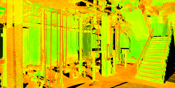
- 3D laser scanning and reality capture for high‑detail as‑builts and 3D modeling
- Mobile and aerial LiDAR for rapid, large‑area data collection
- Bathymetric surveys for underwater mapping and marine infrastructure
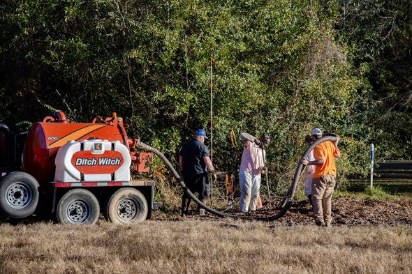
- Integrated SUE services for accurate subsurface utility information
- GIS and mapping support for smarter, data‑driven decision‑making
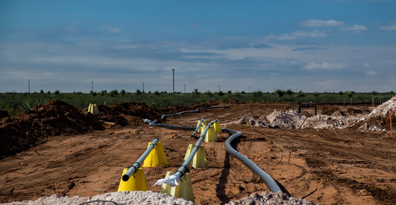
UTILITY ENGINEERING / SUE SERVICES
We identify, locate, and map underground utilities using industry-standard methods and cutting-edge technology. Our comprehensive SUE services help reduce risk, avoid delays, and keep your projects moving forward.
- Full‑spectrum SUE Levels A–D for complete subsurface clarity
- Ground Penetrating Radar (GPR) to detect metallic and non‑metallic utilities
- Vacuum excavation for precise, non‑destructive utility exposure
- Utility coordination to identify conflicts early and streamline design
- ASCE 38‑02 / 38‑22 compliant deliverables for consistent, trusted documentation
- Asset mapping and condition assessments to support long‑term infrastructure planning
ENGINEERING AND DESIGN SERVICES
NTBA provides engineering design with detailed analysis, permitting expertise, and field data services to ensure seamless integration between planning and execution.
- Comprehensive design for upstream, midstream, and downstream infrastructure
- Floodplain management backed by hydrologic and hydraulic modeling
- Sanitary sewer and stormwater system design that meets municipal and environmental standards
- Streamlined permitting support across local, state, and federal agencies
- Utility coordination and relocation planning to prevent conflicts and delays
- Integrated Subsurface Utility Engineering (SUE) for safer, more informed design decisions
GIS AND GEOSPATIAL SERVICES
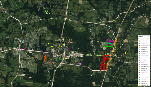
Our geospatial professionals provide custom mapping, data visualization, and remote sensing solutions that turn complex infrastructure networks into clear, actionable intelligence
- High-accuracy field date collection for real-world precision
- Comprehensive utility network mapping for smarter asset planning
- Interactive visualization and analytics that reveal patterns and risks
- Advanced remote sensing and UAS integration for high-resolution imagery and LiDAR
- Cloud-based asset management platforms for real-time data access
- Efficient routing sketch development to support early-stage design
LAND AND REGULATORY
From title research to right-of-way mapping and acquisition support, NTBA offers turnkey land services that streamline project delivery and ensure regulatory compliance.
- Subject Matter Expertise (SME) for strategic guidance across all project phases
- Routing, mapping, and line list development to support planning and engineering
- Exhibit and plat review for accuracy, consistency, and compliance
- Property and title research to verify ownership, easements, and encumbrances
- Acquisition and permitting support to streamline approvals and negotiations
- Construction monitoring and damage settlement to protect timelines and maintain stakeholder trust
INFRASTRUCTURE SUPPORT
- End‑to‑end project coordination that aligns engineering, land, and field operations
- Field data collection and verification to support design and construction accuracy
- Routing, mapping, and documentation for utilities, corridors, and infrastructure assets
- Environmental and regulatory support to maintain compliance and streamline approvals
- Construction monitoring to ensure safety, quality, and adherence to project requirements
- Damage assessment and restoration oversight to protect timelines and stakeholder relationships
This is the text area
Short heading
This is the text area
Short heading
This is the text area
Short heading